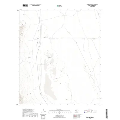
2019 Map of Figure Two Ranch
USGS Topo · Published 2019About this map
Figure Two Ranch sits at the heart of this West Texas landscape, where ranching operations and aviation intersect on the desert floor. The map highlights the Figure 2 Ranch Airport, a private landing strip supporting the remote stationing of this historic landholding. To the west, the terrain rises abruptly into the mountain foothills, carved by Black John Canyon and Marble Canyon, which spill onto the flats.
Find a feature on this map
8 named features on this map. Tap any name to fly to it.
Don’t see what you’re looking for? This feature index may not catch every label — zoom into the map to look around manually.
Map Details
Editions of this 2019 Figure Two Ranch Map
This is the sole edition of this map. No revisions or reprints were ever made.
Other maps of this area

1906 · Van Horn
USGS Topo · 1:125,000

1954 · Van Horn
USGS Topo · 1:250,000

1958 · Van Horn
USGS Topo · 1:250,000

1972 · Square Mesa
USGS Topo · 1:24,000

1973 · Bitter Well Mountain SW
USGS Topo · 1:24,000
1973 · Victorio Peak
USGS Topo · 1:24,000

1973 · Apache Peak
USGS Topo · 1:24,000

1973 · Bitter Well Mountain
USGS Topo · 1:24,000

1973 · Burro Canyon
USGS Topo · 1:24,000
1973 · Seven Heart Gap NW
USGS Topo · 1:24,000