
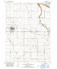
1950 Map of Filer
USGS Topo · Published 1952About this map
The agricultural landscape of Twin Falls County is defined by a sophisticated network of irrigation as it stood in the early 1950s. The town of Filer serves as the central hub, anchored by the County Fairgrounds and a grid of residential blocks adjacent to the Union Pacific rail line. Irrigation is the lifeblood of this high-desert terrain, with the Low Line Canal and High Line Canal carving through the contours of the land, flanked by family-named features like Sucker Flat and Deadman Gulch.
Find a feature on this map
25 named features on this map. Tap any name to fly to it.
Don’t see what you’re looking for? This feature index may not catch every label — zoom into the map to look around manually.
Map Details
Editions of this 1950 Filer Map
2 editions found
Other maps of this area

1950 · Niagara Springs
USGS Topo · 1:24,000

1950 · Jerome
USGS Topo · 1:24,000

1950 · Jerome
USGS Topo · 1:62,500

1951 · Clover
USGS Topo · 1:24,000

1955 · Twin Falls
USGS Topo · 1:250,000

1958 · Twin Falls
USGS Topo · 1:250,000

1964 · Falls City
USGS Topo · 1:24,000

1964 · Twin Falls
USGS Topo · 1:24,000

1965 · Berger
USGS Topo · 1:24,000

1965 · Berger Butte
USGS Topo · 1:24,000