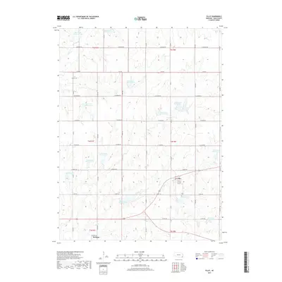
2017 Map of Filley
USGS Topo · Published 2017About this map
Filley serves as the central hub of this Gage County landscape, where the intersection of S 134 Rd and Sargent Rd marks the heart of the village. The surrounding terrain is defined by an intricate network of watershed management features, including Bear Creek Reservoir 7-D, Cedar Creek Reservoir 9-A, and Mud Creek Reservoir 5-A. These reservoirs sit amidst a strictly organized section-line road grid, where family names and local history are preserved at sites like Zion Cem and Filley Cem. To the southwest, the small settlement of Rockford sits near the banks of Mud Creek, illustrating the traditional placement of early Nebraska communities near reliable water sources. The map captures a transition toward modern land management through its numerous named reservoirs along Bear Cr and Cedar Cr.
Find a feature on this map
48 named features on this map. Tap any name to fly to it.
Don’t see what you’re looking for? This feature index may not catch every label — zoom into the map to look around manually.
Map Details
Editions of this 2017 Filley Map
This is the sole edition of this map. No revisions or reprints were ever made.
Other maps of this area

1955 · Lincoln
USGS Topo · 1:250,000

1957 · Lincoln
USGS Topo · 1:250,000

1957 · Beatrice East
USGS Topo · 1:24,000

1958 · Lincoln
USGS Topo · 1:250,000

1964 · Pickrell
USGS Topo · 1:24,000

1964 · Blue Springs
USGS Topo · 1:24,000

1965 · Adams
USGS Topo · 1:24,000

1965 · Crab Orchard
USGS Topo · 1:24,000

1965 · Sterling
USGS Topo · 1:24,000

1965 · Lewiston
USGS Topo · 1:24,000