
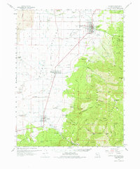
1962 Map of Fillmore
USGS Topo · Published 1963About this map
The Pavant Range and the volcanic landscape of The Cinders dominate this 1962 topographical study of eastern Millard County. The settlement pattern follows the base of the mountains, where water from Chalk Creek and Corn Creek supports the towns of Fillmore, Meadow, and Kanosh. A notable cultural boundary, the Old Indian Treaty Boundary, bisects the valley, reflecting the historical division of lands between settlers and indigenous populations. Near the southern edge of the sheet lies the Kanosh Indian Village, situated just north of the Kanosh Cem.
Find a feature on this map
67 named features on this map. Tap any name to fly to it.
Don’t see what you’re looking for? This feature index may not catch every label — zoom into the map to look around manually.
Map Details
Editions of this 1962 Fillmore Map
2 editions found
Other maps of this area

1885 · Beaver
USGS Topo · 1:250,000

1885 · Sevier Desert
USGS Topo · 1:250,000

1932 · Sevier
USGS Topo · 1:62,500

1935 · Sevier
USGS Topo · 1:62,500

1940 · Monroe
USGS Topo · 1:62,500

1944 · Monroe
USGS Topo · 1:62,500

1953 · Richfield
USGS Topo · 1:250,000

1953 · Delta
USGS Topo · 1:250,000

1958 · Richfield
USGS Topo · 1:250,000

1958 · Delta
USGS Topo · 1:250,000