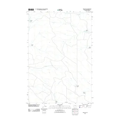
2011 Map of Finch NE
USGS Topo · Published 2011About this map
Castle Butte rises above a landscape defined by an extensive system of small-scale water management in central Montana. This 2011 survey reveals the systematic impoundment of seasonal drainages, where numerous family-named earthen structures like Johnson Number 1 Dam, Harstad Number 1 Dam, and Watson Number 1 Dam dot the rangeland. These features, along with several others such as Gearhart Number 11 Dam and Montana Number 6 Dam, illustrate the critical importance of water retention for livestock and land use in this arid region. The drainage network is anchored by Living Ash Creek and the North Prong Hay Creek, while Greasewood Creek and Dry Creek meander through the southern sections. This map provides a detailed view of these rural developments and the named landmarks that anchor local land ownership records and ranching history in Rosebud County.
Find a feature on this map
13 named features on this map. Tap any name to fly to it.
Don’t see what you’re looking for? This feature index may not catch every label — zoom into the map to look around manually.
Map Details
Editions of this 2011 Finch NE Map
This is the sole edition of this map. No revisions or reprints were ever made.
Other maps of this area

1954 · Forsyth
USGS Topo · 1:250,000

1957 · Forsyth
USGS Topo · 1:250,000

1958 · Forsyth
USGS Topo · 1:250,000

1968 · Donleys Reservoir
USGS Topo · 1:24,000

1968 · Nichols
USGS Topo · 1:24,000

1968 · Forsyth
USGS Topo · 1:24,000

1968 · Finch NE
USGS Topo · 1:24,000

1968 · Black Coulee
USGS Topo · 1:24,000

1968 · Finch
USGS Topo · 1:24,000

1969 · Flat Bottom Coulee SW
USGS Topo · 1:24,000