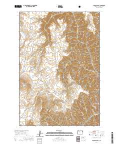
2020 Map of Findley Buttes
USGS Topo · Published 2020About this map
Findley Buttes Méexsem Héepey Butte rises prominently in this high-desert landscape, reflecting the Indigenous Nez Perce heritage of Wallowa County. The terrain is defined by a series of deep drainage systems, including Stickney Gulch and Imnaha Gulch, which carve into the ridges toward the east. This 2020 survey illustrates the remote character of the Wallowa National Forest, where the land is primarily organized by natural features rather than dense settlement. Essential travel routes like Old Imnaha Rd and N Pine Rd provide the only significant access through these steep canyons. Water sources such as Little Sheep Cr and Cottonwood Cr dictate the local geography, flowing between landmarks like Harsin Butte and the extensive Long Ridge. The map documents a contemporary state of this protected forest land, preserving the exact relationship between traditional Nez Perce place names and the established topographical survey points.
Find a feature on this map
22 named features on this map. Tap any name to fly to it.
Don’t see what you’re looking for? This feature index may not catch every label — zoom into the map to look around manually.
Map Details
Editions of this 2020 Findley Buttes Map
This is the sole edition of this map. No revisions or reprints were ever made.
Other maps of this area

1954 · Imnaha
USGS Topo · 1:62,500

1954 · Harl Butte
USGS Topo · 1:62,500

1955 · Grangeville
USGS Topo · 1:250,000

1957 · Joseph
USGS Topo · 1:62,500

1957 · Elk Mountain
USGS Topo · 1:62,500

1959 · Grangeville
USGS Topo · 1:250,000

1980 · Grangeville
USGS Topo · 1:100,000

1982 · Wallowa
USGS Topo · 1:100,000

1986 · Enterprise
USGS Topo · 1:100,000

1987 · Riggins
USGS Topo · 1:100,000