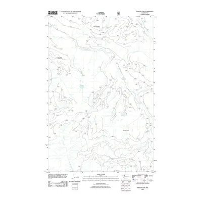
2011 Map of Findley Lake
USGS Topo · Published 2011About this map
The Cedar River Watershed dominates this high-altitude landscape in the Cascade Range, protecting the source of a critical regional water supply. This 2011 survey reveals a complex network of forest development roads, such as Nat For Dev Rd 5000 and NFD 5053 Rd, which traverse the steep slopes between Mount Gardner and Goat Mountain. These routes provide access to isolated outposts like Bear Creek Cabin and City Cabin.
Find a feature on this map
34 named features on this map. Tap any name to fly to it.
Don’t see what you’re looking for? This feature index may not catch every label — zoom into the map to look around manually.
Map Details
Editions of this 2011 Findley Lake Map
This is the sole edition of this map. No revisions or reprints were ever made.
Other maps of this area

1901 · Snoqualmie Pass
USGS Topo · 1:125,000

1903 · Snoqualmie
USGS Topo · 1:125,000

1913 · Cedar Lake
USGS Topo · 1:125,000

1956 · Greenwater
USGS Topo · 1:62,500

1957 · Wenatchee
USGS Topo · 1:250,000

1960 · Bandera
USGS Topo · 1:62,500

1961 · Snoqualmie Pass
USGS Topo · 1:62,500

1962 · Lester
USGS Topo · 1:62,500

1975 · Snoqualmie Pass
USGS Topo · 1:100,000
1986 · Nagrom
USGS Topo · 1:24,000