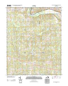
2013 Map of Fine Creek Mills
USGS Topo · Published 2013About this map
The James River defines the northern reaches of this landscape near Lee, where historical mill sites and modern developments meet. This area, centered on the settlement of Fine Creek Mills, reveals a transition from the river-based industry of the past to a residential and agricultural patchwork. Local commerce and land use are anchored by water features such as Krouses Mill and Byers Millpond, while aviation history is represented by the Spring Valley Airport. To the south, the Anderson Hwy corridor connects established communities like Flat Rock and Lilburn, showing the evolution of local transit routes away from the river toward regional highways. Genealogists and historians can trace numerous family-named landmarks and water bodies, including Upper Byers Lake and Lake Shawnee, which reflect the long-standing importance of water management for both power and recreation in this part of Goochland County.
Find a feature on this map
129 named features on this map. Tap any name to fly to it.
Don’t see what you’re looking for? This feature index may not catch every label — zoom into the map to look around manually.
Map Details
Editions of this 2013 Fine Creek Mills Map
This is the sole edition of this map. No revisions or reprints were ever made.
Other maps of this area

1890 · Goochland
USGS Topo · 1:125,000

1892 · Goochland
USGS Topo · 1:125,000

1897 · Amelia
USGS Topo · 1:125,000

1943 · Goochland
USGS Topo · 1:31,680

1943 · Fine Creek Mills
USGS Topo · 1:31,680

1943 · Powhatan
USGS Topo · 1:31,680

1943 · Perkinsville
USGS Topo · 1:31,680

1943 · Hallsboro
USGS Topo · 1:31,680

1943 · Clayville
USGS Topo · 1:24,000

1943 · Midlothian
USGS Topo · 1:24,000