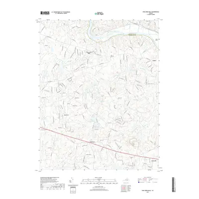
2019 Map of Fine Creek Mills
USGS Topo · Published 2019About this map
The James River carves the northern boundary of this Piedmont landscape, separating Lee in Goochland County from the historic communities of Powhatan County. The namesake village of Fine Creek Mills sits just south of the river, reflecting a settlement pattern deeply tied to the falls and power of Fine Creek. This area is characterized by its legacy of milling and rural crossroads, with small hamlets like Subletts and Red Lane serving as local anchors. Further south, the landscape opens toward Flat Rock, where the road network transitions toward the southern county line.
Find a feature on this map
152 named features on this map. Tap any name to fly to it.
Don’t see what you’re looking for? This feature index may not catch every label — zoom into the map to look around manually.
Map Details
Editions of this 2019 Fine Creek Mills Map
This is the sole edition of this map. No revisions or reprints were ever made.
Other maps of this area

1890 · Goochland
USGS Topo · 1:125,000

1892 · Goochland
USGS Topo · 1:125,000

1897 · Amelia
USGS Topo · 1:125,000

1943 · Goochland
USGS Topo · 1:31,680

1943 · Fine Creek Mills
USGS Topo · 1:31,680

1943 · Powhatan
USGS Topo · 1:31,680

1943 · Perkinsville
USGS Topo · 1:31,680

1943 · Hallsboro
USGS Topo · 1:31,680

1943 · Clayville
USGS Topo · 1:24,000

1943 · Midlothian
USGS Topo · 1:24,000