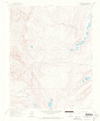
1964 Map of Finger Mesa
USGS Topo · Published 1967About this map
The Continental Divide snake through the high elevations of this 1960s survey, marking a watershed boundary that defines the character of the San Juan Mountains. The landscape is a network of alpine basins and drainages, where North Clear Creek and South Clear Creek gather from groups like the Pearl Lakes and Hermit Lakes. This era shows the high country as a place of managed forestry and seasonal ranching, with the Gunnison National Forest and Rio Grande National Forest meeting along the divide.
Find a feature on this map
34 named features on this map. Tap any name to fly to it.
Don’t see what you’re looking for? This feature index may not catch every label — zoom into the map to look around manually.
Map Details
Editions of this 1964 Finger Mesa Map
3 editions found
Other maps of this area

1905 · San Cristobal
USGS Topo · 1:125,000

1907 · San Cristobal
USGS Topo · 1:125,000

1945 · Durango
USGS Topo · 1:250,000

1953 · Durango
USGS Topo · 1:250,000

1954 · Durango
USGS Topo · 1:250,000

1959 · Bristol Head
USGS Topo · 1:62,500

1961 · Durango
USGS Topo · 1:250,000

1963 · Durango
USGS Topo · 1:250,000
1964 · Rio Grande Pyramid
USGS Topo · 1:24,000
1964 · Finger Mesa
USGS Topo · 1:24,000