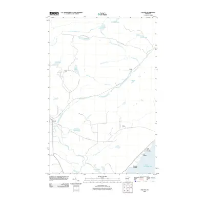
2010 Map of Finland
USGS Topo · Published 2010About this map
Finland sits as a central settlement in this North Shore interior landscape, where the Baptism River and its East Branch carve through the timbered terrain. The 2010 survey shows a network of forest roads and local routes like Sonju Lake Forest Rd and Airbase Rd connecting isolated homesteads and recreation sites. Along the cold coast of Lake Superior, small harbors and landings such as Bell Harbor and Kennedy Landing provide access to the water, while the Little Marais Postoffice serves as a vital local waypoint. The map documents numerous inland water bodies including Sonju Lake, Egge Lake, and Lake Twentythree, reflecting the glacial legacy of Lake County. Cultural landmarks such as the Finland Lookout Tower and the Finland Cemetery offer specific points of interest for local history researchers and genealogists tracing family roots in this corner of Minnesota.
Find a feature on this map
39 named features on this map. Tap any name to fly to it.
Don’t see what you’re looking for? This feature index may not catch every label — zoom into the map to look around manually.
Map Details
Editions of this 2010 Finland Map
This is the sole edition of this map. No revisions or reprints were ever made.
Other maps of this area

1954 · Silver Bay
USGS Topo · 1:62,500

1954 · Two Harbors
USGS Topo · 1:250,000

1955 · Isabella
USGS Topo · 1:62,500

1955 · Cramer
USGS Topo · 1:62,500

1956 · Little Marais
USGS Topo · 1:24,000

1956 · Finland
USGS Topo · 1:24,000

1956 · Finland
USGS Topo · 1:62,500

1956 · Illgen City
USGS Topo · 1:24,000

1957 · Two Harbors
USGS Topo · 1:250,000

1958 · Two Harbors
USGS Topo · 1:250,000