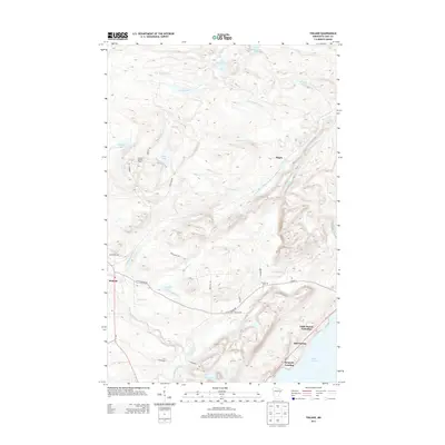
2013 Map of Finland
USGS Topo · Published 2013About this map
Finland and its surrounding North Shore uplands are defined by a complex drainage network feeding into Lake Superior. The landscape is dominated by the Baptism River and its various branches, including the E Br Baptism River, which cut through the high ground before reaching the lake at Bell Harbor. Numerous small bodies of water such as Sonju Lake, Lake Twentythree, and Leskinen Lake are scattered across the terrain, reflecting the glaciated history of Lake County. Significant local landmarks include the Finland Lookout Tower and the Finland Cem. Along the shoreline, small coastal hubs like Kennedy Landing and the Little Marais Postoffice illustrate the historical importance of the lakefront for transportation and communication in this part of Minnesota.
Find a feature on this map
40 named features on this map. Tap any name to fly to it.
Don’t see what you’re looking for? This feature index may not catch every label — zoom into the map to look around manually.
Map Details
Editions of this 2013 Finland Map
This is the sole edition of this map. No revisions or reprints were ever made.
Other maps of this area

1954 · Silver Bay
USGS Topo · 1:62,500

1954 · Two Harbors
USGS Topo · 1:250,000

1955 · Isabella
USGS Topo · 1:62,500

1955 · Cramer
USGS Topo · 1:62,500

1956 · Little Marais
USGS Topo · 1:24,000

1956 · Finland
USGS Topo · 1:24,000

1956 · Finland
USGS Topo · 1:62,500

1956 · Illgen City
USGS Topo · 1:24,000

1957 · Two Harbors
USGS Topo · 1:250,000

1958 · Two Harbors
USGS Topo · 1:250,000