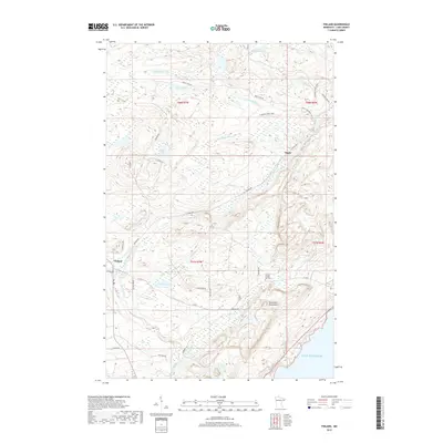
2019 Map of Finland
USGS Topo · Published 2019About this map
Finland stands as the primary settlement in this corner of Lake County, situated where the East Branch Baptism River meets the larger drainage system flowing toward the North Shore. The landscape is defined by the sharp rise of the Sawtooth Mountains, which create a dramatic backdrop just inland from the cold waters of Lake Superior. This survey documents a wilderness increasingly accessed by a network of forest roads and trails, including Cramer Rd and the N Shore State Trail, which cut through dense topography marked by high-elevation lakes like Sonju Lake and Egge Lake. For those researching local roots, the Finland Crystal Bay Cem remains a significant landmark near the junction of Co Rd 6 and Leskinen Rd. The area's geography is further characterized by numerous named tributaries, such as Schoolhouse Cr and Leskinen Cr, which feed the river systems carved into the ancient rock of the Arrowhead region.
Find a feature on this map
42 named features on this map. Tap any name to fly to it.
Don’t see what you’re looking for? This feature index may not catch every label — zoom into the map to look around manually.
Map Details
Editions of this 2019 Finland Map
This is the sole edition of this map. No revisions or reprints were ever made.
Other maps of this area

1954 · Silver Bay
USGS Topo · 1:62,500

1954 · Two Harbors
USGS Topo · 1:250,000

1955 · Isabella
USGS Topo · 1:62,500

1955 · Cramer
USGS Topo · 1:62,500

1956 · Little Marais
USGS Topo · 1:24,000

1956 · Finland
USGS Topo · 1:24,000

1956 · Finland
USGS Topo · 1:62,500

1956 · Illgen City
USGS Topo · 1:24,000

1957 · Two Harbors
USGS Topo · 1:250,000

1958 · Two Harbors
USGS Topo · 1:250,000