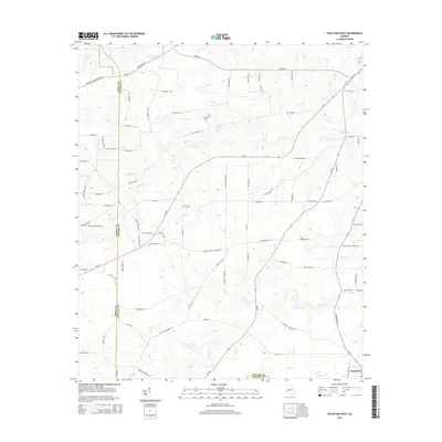
2014 Map of Finleyson West
USGS Topo · Published 2014About this map
Finleyson anchors the southeastern corner of this Georgia landscape, situated where the Pulaski Co and Wilcox Co lines meet. The terrain is defined by a dense network of hydrologic features that likely supported early regional industry, notably Fountain Millpond and several watercourses including Cedar Cr and Double Br Cr. The presence of Mock Spring and extensive creek systems like Tenmile Cr and Bluff Cr indicate a well-watered agricultural territory where land use is dictated by the drainage patterns of these many branches. Local transit is dominated by Ga 27 and the Unadilla Hwy, which cut through the rural holdings of Pulaski County. This area maintains its agricultural character, evidenced by the numerous named fire roads and secondary routes like Tom Taylor Rd and Dan Sparrow Rd that connect the various farmsteads and creek crossings.
Find a feature on this map
85 named features on this map. Tap any name to fly to it.
Don’t see what you’re looking for? This feature index may not catch every label — zoom into the map to look around manually.
Map Details
Editions of this 2014 Finleyson West Map
This is the sole edition of this map. No revisions or reprints were ever made.
Other maps of this area

1956 · Cochran
USGS Topo · 1:62,500

1956 · Perry
USGS Topo · 1:62,500

1957 · Macon
USGS Topo · 1:250,000

1958 · Macon
USGS Topo · 1:250,000

1964 · Macon
USGS Topo · 1:250,000

1971 · Pineview West
USGS Topo · 1:24,000

1971 · Pineview NW
USGS Topo · 1:24,000

1971 · Pineview SW
USGS Topo · 1:24,000

1972 · Finleyson East
USGS Topo · 1:24,000

1972 · Finleyson West
USGS Topo · 1:24,000