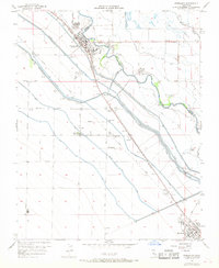
1956 Map of Firebaugh
USGS Topo · Published 1968About this map
The San Joaquin River carves through the central valley landscape of this 1956 survey, serving as both a natural boundary and the lifeblood for a complex irrigation network. The agricultural character of the region is defined by an intricate system of waterways, including the Delta-Mendota Canal, Main Canal, and Outside Canal. Near the town of Firebaugh, the Southern Pacific railroad parallels the river, anchoring local industry represented by a Seed Plant and several Grain Tanks.
Find a feature on this map
59 named features on this map. Tap any name to fly to it.
Don’t see what you’re looking for? This feature index may not catch every label — zoom into the map to look around manually.
Map Details
Editions of this 1956 Firebaugh Map
3 editions found
Other maps of this area

1913 · Panoche
USGS Topo · 1:125,000

1921 · Mendota
USGS Topo · 1:31,680

1922 · Oxalis
USGS Topo · 1:31,680

1922 · Tufts Ranch
USGS Topo · 1:31,680

1922 · Pozo Farm
USGS Topo · 1:31,680

1922 · Kentucky Well
USGS Topo · 1:31,680

1922 · Chaney Ranch
USGS Topo · 1:31,680

1923 · Wisdom Well
USGS Topo · 1:31,680

1923 · Firebaugh
USGS Topo · 1:31,680

1924 · Tranquillity
USGS Topo · 1:31,680