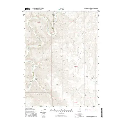
2017 Map of Firewater Canyon North
USGS Topo · Published 2017About this map
The Green River snakes through the high desert of the Uintah Basin, carving a complex system of canyons along the border of Uintah and Carbon counties. This 2017 topographic study highlights a landscape defined by its hydrology, where river runners and geologists track significant water features such as Rock House Riffle, Jack Creek Rapids, and Firewater Rapids. The steep elevation changes are marked by prominent landmarks like Peters Point and Gray Knoll, which overlook deep drainages including Rock House Canyon and West Tabyago Canyon. The mapping of flat riparian areas like Rock House Bottom and Big Canyon Flat among the vertical relief provides essential context for understanding land use and navigation in this arid region. This survey serves as a modern record of the shifting river channel and the established boundaries of the Uintah and Ouray Reservation area.
Find a feature on this map
28 named features on this map. Tap any name to fly to it.
Don’t see what you’re looking for? This feature index may not catch every label — zoom into the map to look around manually.
Map Details
Editions of this 2017 Firewater Canyon North Map
This is the sole edition of this map. No revisions or reprints were ever made.
Other maps of this area

1885 · East Tavaputs
USGS Topo · 1:250,000

1886 · Price River
USGS Topo · 1:250,000

1896 · Price River
USGS Topo · 1:250,000

1953 · Nutters Hole
USGS Topo · 1:62,500

1953 · Firewater Canyon
USGS Topo · 1:62,500

1954 · Flat Canyon
USGS Topo · 1:62,500

1956 · Price
USGS Topo · 1:250,000

1956 · Grand Junction
USGS Topo · 1:250,000

1959 · Grand Junction
USGS Topo · 1:250,000

1960 · Price
USGS Topo · 1:250,000