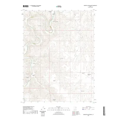
2020 Map of Firewater Canyon North
USGS Topo · Published 2020About this map
The Green River snakes through the high desert of the Uintah Basin, carving a complex network of canyons along the border of Carbon and Uintah Counties. This modern survey details the river's descent through a series of named whitewater features, including Little Rock House Riffle, Jack Creek Rapids, and Firewater Rapids. The topography is dominated by dramatic elevation changes from the river bottom up to prominent overlooks like Peters Point and Nutters Rock.
Find a feature on this map
22 named features on this map. Tap any name to fly to it.
Don’t see what you’re looking for? This feature index may not catch every label — zoom into the map to look around manually.
Map Details
Editions of this 2020 Firewater Canyon North Map
This is the sole edition of this map. No revisions or reprints were ever made.
Other maps of this area

1885 · East Tavaputs
USGS Topo · 1:250,000

1886 · Price River
USGS Topo · 1:250,000

1896 · Price River
USGS Topo · 1:250,000

1953 · Nutters Hole
USGS Topo · 1:62,500

1953 · Firewater Canyon
USGS Topo · 1:62,500

1954 · Flat Canyon
USGS Topo · 1:62,500

1956 · Price
USGS Topo · 1:250,000

1956 · Grand Junction
USGS Topo · 1:250,000

1959 · Grand Junction
USGS Topo · 1:250,000

1960 · Price
USGS Topo · 1:250,000