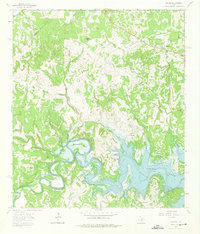
1963 Map of Fischer
USGS Topo · Published 1975About this map
Canyon Lake dominates the southeastern portion of this map, reflecting the transformation of the Guadalupe River valley following the mid-century construction of the dam. The landscape transitions from the river's winding course at Demijohn Bend and Cordova Bend to the broader expanse of the reservoir, where the terrain is marked by remnants of earlier settlement. Small communities like Fischer and Cranes Mill serve as focal points for local history, while the presence of the Bremer Cem and family-named landmarks like Kuhn Hill and Big Head Mountain offer important data for genealogical research. The map also captures local infrastructure of the era, including a Landing Strip, a Gravel Pit, and various roads like Cranes Mill Road that connected these rural Texas Hill Country outposts before further modernization.
Find a feature on this map
26 named features on this map. Tap any name to fly to it.
Don’t see what you’re looking for? This feature index may not catch every label — zoom into the map to look around manually.
Map Details
Editions of this 1963 Fischer Map
2 editions found
Other maps of this area

1887 · Blanco
USGS Topo · 1:125,000

1894 · Blanco
USGS Topo · 1:125,000

1920 · Smithsons Valley
USGS Topo · 1:62,500

1925 · Hunter No 3
USGS Topo · 1:48,000

1925 · Smithson Valley No. 1
USGS Topo · 1:48,000

1927 · Smithson Valley
USGS Topo · 1:62,500

1929 · Hunter
USGS Topo · 1:62,500

1929 · Smithson Valley
USGS Topo · 1:62,500

1940 · Smithson Valley
USGS Topo · 1:62,500

1954 · Llano
USGS Topo · 1:250,000