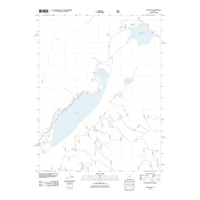
2011 Map of Fish Lake
USGS Topo · Published 2011About this map
Fish Lake dominates this high-altitude landscape in central Utah, serving as a focal point for a complex network of alpine hydrology and forest management roads. The map illustrates a significant watershed where Lake Creek and Jorgenson Creek feed into the lake's northern end, while the southern reaches transition into the marshy Coots Slough. To the northeast, the Johnson Valley Reservoir and the adjacent Reflection Spring indicate the managed nature of these water resources, supported by the Fremont River Rd and various Forest Service routes like F S 640.
Find a feature on this map
23 named features on this map. Tap any name to fly to it.
Don’t see what you’re looking for? This feature index may not catch every label — zoom into the map to look around manually.
Map Details
Editions of this 2011 Fish Lake Map
This is the sole edition of this map. No revisions or reprints were ever made.
Other maps of this area

1885 · Fish Lake
USGS Topo · 1:250,000

1896 · Fish Lake
USGS Topo · 1:250,000

1952 · Loa 1 NE
USGS Topo · 1:24,000

1956 · Salina
USGS Topo · 1:250,000

1960 · Salina
USGS Topo · 1:250,000

1962 · Salina
USGS Topo · 1:250,000

1967 · Lyman
USGS Topo · 1:24,000

1968 · Fish Lake
USGS Topo · 1:24,000
1968 · Hilgard Mtn
USGS Topo · 1:24,000
1968 · Boobe Hole Reservoir
USGS Topo · 1:24,000