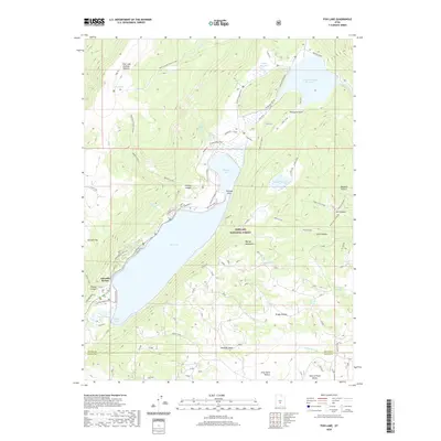
2020 Map of Fish Lake
USGS Topo · Published 2020About this map
Fish Lake dominates this high-altitude basin within the Fishlake National Forest, where the waters are contained by the steep rise of the Fish Lake Hightop Plateau to the west and the Mytoge Mountains to the east. The 2020 shoreline is characterized by distinct points and inlets, including Pelican Point, Widgeon Bay, and Mallard Bay. Human activity is concentrated along the western and northern edges, anchored by the Lakeside Resort and several structured recreation sites like Doctor Creek Cg and Tasha Cg.
Find a feature on this map
67 named features on this map. Tap any name to fly to it.
Don’t see what you’re looking for? This feature index may not catch every label — zoom into the map to look around manually.
Map Details
Editions of this 2020 Fish Lake Map
This is the sole edition of this map. No revisions or reprints were ever made.
Other maps of this area

1885 · Fish Lake
USGS Topo · 1:250,000

1896 · Fish Lake
USGS Topo · 1:250,000

1952 · Loa 1 NE
USGS Topo · 1:24,000

1956 · Salina
USGS Topo · 1:250,000

1960 · Salina
USGS Topo · 1:250,000

1962 · Salina
USGS Topo · 1:250,000

1967 · Lyman
USGS Topo · 1:24,000

1968 · Fish Lake
USGS Topo · 1:24,000
1968 · Hilgard Mtn
USGS Topo · 1:24,000
1968 · Boobe Hole Reservoir
USGS Topo · 1:24,000