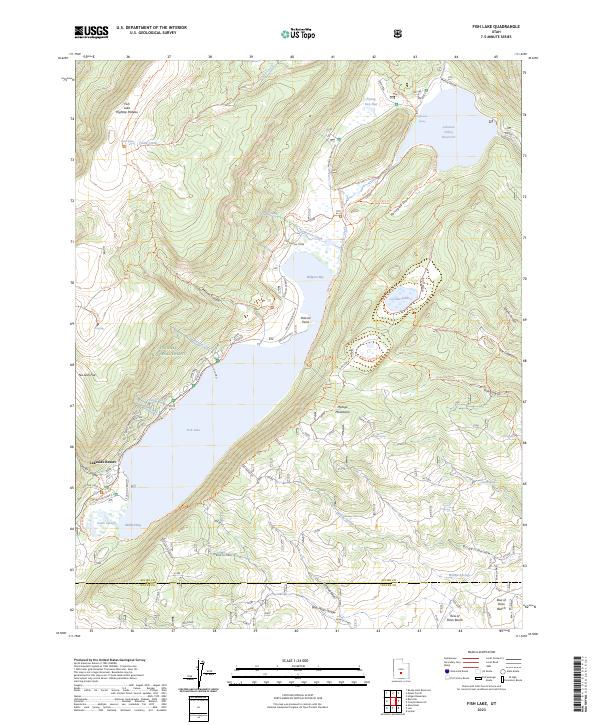
2023 Map of Fish Lake
USGS Topo · Published 2023About this map
Fishlake National Forest dominates this high-altitude landscape, centered on the massive alpine basin of Fish Lake. The map reveals a complex system of recreation and water management, with Lakeside Resort serving as a hub on the western shore and multiple established campsites like Doctor Creek C G and Tasha CG ringing the water. To the northeast, the Fremont River feeds into the Johnson Valley Reservoir, illustrating the vital role this watershed plays in regional water storage.
Find a feature on this map
66 named features on this map. Tap any name to fly to it.
Don’t see what you’re looking for? This feature index may not catch every label — zoom into the map to look around manually.
Map Details
Editions of this 2023 Fish Lake Map
This is the sole edition of this map. No revisions or reprints were ever made.
Other maps of this area

1885 · Fish Lake
USGS Topo · 1:250,000

1896 · Fish Lake
USGS Topo · 1:250,000

1952 · Loa 1 NE
USGS Topo · 1:24,000

1956 · Salina
USGS Topo · 1:250,000

1960 · Salina
USGS Topo · 1:250,000

1962 · Salina
USGS Topo · 1:250,000

1967 · Lyman
USGS Topo · 1:24,000

1968 · Fish Lake
USGS Topo · 1:24,000
1968 · Hilgard Mtn
USGS Topo · 1:24,000
1968 · Boobe Hole Reservoir
USGS Topo · 1:24,000