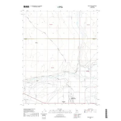
2018 Map of Fish Slough
USGS Topo · Published 2018About this map
Volcanic Tableland dominates the northern landscape of this 2018 survey, where the Mono and Inyo county line divides the arid high-desert terrain. The eastern edge is defined by the winding course of Fish Slough, while the southern portion of the quadrangle transitions into the irrigated agricultural and residential areas north of Bishop. Here, the complex water management systems of the Owens Valley are on full display, featuring the Owens Canal, Uper Canal, and Lower McNally Canal alongside the natural flow of the Owens River. Local landmarks like Chalk Bluff and Pleasant Valley overlook a network of rural roads such as Casa Diablo Rd. Near the southern border, the community of Dixon Lane-Meadow Creek and the junction at Brockmans Corner mark the more settled reaches of the valley floor.
Find a feature on this map
47 named features on this map. Tap any name to fly to it.
Don’t see what you’re looking for? This feature index may not catch every label — zoom into the map to look around manually.
Map Details
Editions of this 2018 Fish Slough Map
This is the sole edition of this map. No revisions or reprints were ever made.
Other maps of this area

1912 · Mt. Goddard
USGS Topo · 1:125,000

1913 · Bishop
USGS Topo · 1:125,000

1914 · Mt. Morrison
USGS Topo · 1:125,000

1917 · White Mountain
USGS Topo · 1:125,000

1947 · Mariposa
USGS Topo · 1:250,000

1948 · Mariposa
USGS Topo · 1:250,000

1949 · Mt. Tom
USGS Topo · 1:62,500

1949 · Bishop
USGS Topo · 1:62,500

1951 · Mt. Tom
USGS Topo · 1:62,500

1951 · Bishop
USGS Topo · 1:62,500
Featured Places
- Bishop, CA
- Dixon Lane–Meadow Creek, Dixon Lane-Meadow Creek
- West Bishop, CA
- Brockmans Corner, Dixon Lane-Meadow Creek