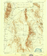
1910 Map of Fish Springs
USGS Topo · Published 1943About this map
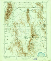
The Deep Creek Range and the high desert basins of the Great Basin dominate this 1908 survey, capturing the rugged interior of western Utah during an era of isolated ranching and localized mining. The landscape is defined by the stark transition from the Great Salt Lake Desert in the north to the jagged peaks of the Fish Springs Range and the Thomas Range. Settlement patterns follow the scarce water sources, as seen at the Thomas' Ranch and various outposts like Callao and Smithville.
Find a feature on this map
90 named features on this map. Tap any name to fly to it.
Don’t see what you’re looking for? This feature index may not catch every label — zoom into the map to look around manually.
Map Details
Editions of this 1910 Fish Springs Map
6 editions found
Other maps of this area

1885 · Beaver
USGS Topo · 1:250,000

1885 · Sevier Desert
USGS Topo · 1:250,000

1885 · Tooele Valley
USGS Topo · 1:250,000

1908 · Fish Springs
USGS Topo · 1:250,000

1910 · Fish Springs
USGS Topo · 1:250,000

1925 · Gold Hill
USGS Topo · 1:62,500

1928 · Gold Hill
USGS Topo · 1:62,500

1949 · Garrison
USGS Topo · 1:62,500

1951 · Garrison
USGS Topo · 1:62,500

1953 · Dugway Range NE
USGS Topo · 1:24,000