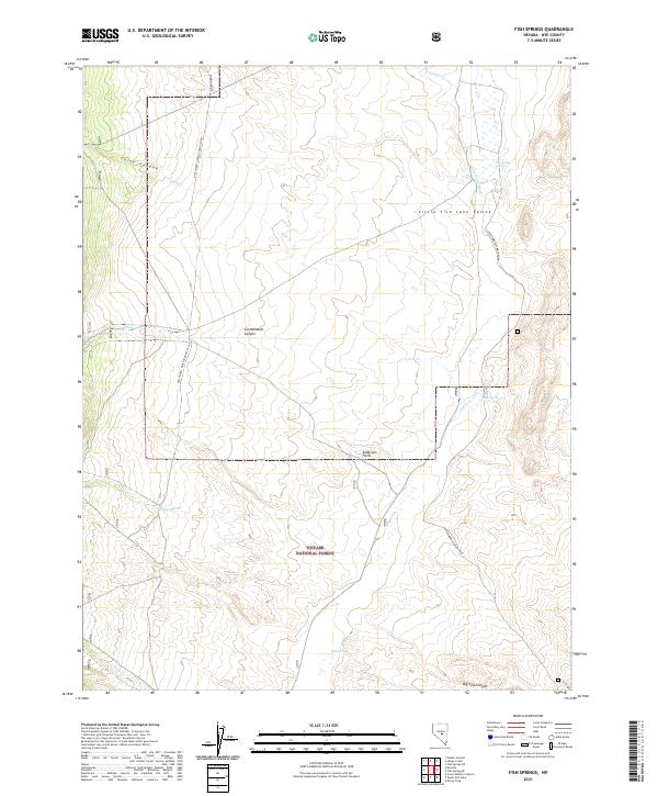
2021 Map of Fish Springs
USGS Topo · Published 2021About this map
Little Fish Lake Valley serves as the central drainage for this section of the Toiyabe National Forest, where a network of ephemeral washes and perennial springs defines the high-desert landscape. The area is marked by significant topographical relief, transitioning from the valley floor into Tulle Canyon and Cottonwood Canyon. Water sources are critical landmarks in this arid environment, represented by named features such as Sevenmile Spring and the eponymous Fish Springs near the southern boundary.
Find a feature on this map
22 named features on this map. Tap any name to fly to it.
Don’t see what you’re looking for? This feature index may not catch every label — zoom into the map to look around manually.
Map Details
Editions of this 2021 Fish Springs Map
This is the sole edition of this map. No revisions or reprints were ever made.
Other maps of this area

1956 · Tonopah
USGS Topo · 1:250,000

1959 · Tonopah
USGS Topo · 1:250,000

1962 · Tonopah
USGS Topo · 1:250,000

1967 · Upper Fish Lake
USGS Topo · 1:24,000

1967 · Morey Peak
USGS Topo · 1:24,000

1968 · Morey Peak
USGS Topo · 1:62,500

1968 · Fish Springs
USGS Topo · 1:62,500
1968 · Stargo Creek
USGS Topo · 1:24,000
1968 · Fish Springs NE
USGS Topo · 1:24,000
1968 · Fish Springs SE
USGS Topo · 1:24,000