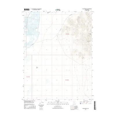
2017 Map of Fish Springs SE
USGS Topo · Published 2017About this map
Pony Express Rd cuts across the arid landscape of Juab County, Utah, following a path steeped in the history of the Old West. This 2017 survey highlights a desert environment where water management and bird habitat take center stage. A series of managed wetlands, including Ibis Pool, Egret Pool, Shoveler Pool, Curlew Pool, and Avocet Pool, provide a stark contrast to the vast, open expanse of Fish Springs Flat. The terrain rises sharply to the east, defined by the Black Rock Hills and the deep incision of Goshoot Canyon. This area illustrates the specialized geography of the Great Basin, where seasonal drainages like Fish Springs Wash navigate the interface between mountain ranges and expansive salt flats, preserving a remote corridor once vital to transcontinental communication.
Find a feature on this map
13 named features on this map. Tap any name to fly to it.
Don’t see what you’re looking for? This feature index may not catch every label — zoom into the map to look around manually.
Map Details
Editions of this 2017 Fish Springs SE Map
This is the sole edition of this map. No revisions or reprints were ever made.
Other maps of this area

1908 · Fish Springs
USGS Topo · 1:250,000

1910 · Fish Springs
USGS Topo · 1:250,000

1953 · Dugway Range
USGS Topo · 1:62,500

1953 · Topaz Mtn
USGS Topo · 1:62,500

1953 · Dugway Range NW
USGS Topo · 1:24,000

1953 · Delta
USGS Topo · 1:250,000

1958 · Delta
USGS Topo · 1:250,000

1962 · Delta
USGS Topo · 1:250,000

1967 · Sand Pass NW
USGS Topo · 1:24,000

1967 · Fish Springs NW
USGS Topo · 1:24,000