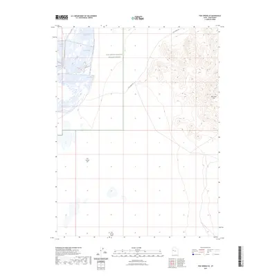
2023 Map of Fish Springs SE
USGS Topo · Published 2023About this map
Fish Springs National Wildlife Refuge dominates this section of Juab County, Utah, where a system of managed wetlands contrasts sharply with the arid Great Basin landscape. These waters, including Egret Pool, Shoveler Pool, and Curlew Pool, provide a critical sanctuary within the broader Fish Springs Flat. The terrain to the east rises sharply into the Black Rock Hills, revealing the stark geological transition from basin floor to upland. Cutting across the northern expanse is the historic route of the Pony Express Rd, a trace of nineteenth-century communication and transit that remains a primary corridor through this isolated region. The presence of Fish Springs Wash further illustrates the intermittent drainage patterns that define the hydrology of this high-desert environment.
Find a feature on this map
10 named features on this map. Tap any name to fly to it.
Don’t see what you’re looking for? This feature index may not catch every label — zoom into the map to look around manually.
Map Details
Editions of this 2023 Fish Springs SE Map
This is the sole edition of this map. No revisions or reprints were ever made.
Other maps of this area

1908 · Fish Springs
USGS Topo · 1:250,000

1910 · Fish Springs
USGS Topo · 1:250,000

1953 · Dugway Range
USGS Topo · 1:62,500

1953 · Topaz Mtn
USGS Topo · 1:62,500

1953 · Dugway Range NW
USGS Topo · 1:24,000

1953 · Delta
USGS Topo · 1:250,000

1958 · Delta
USGS Topo · 1:250,000

1962 · Delta
USGS Topo · 1:250,000

1967 · Sand Pass NW
USGS Topo · 1:24,000

1967 · Fish Springs NW
USGS Topo · 1:24,000