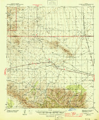
1944 Map of Fisher Hills
USGS Topo · Published 1944About this map
Southern Pacific tracks cut a distinct line through the high desert of southeast Arizona, anchoring small sidings and railroad-dependent locales like Luzena and Raso. This mid-century survey captures a landscape of cattle ranching and rail infrastructure where the Graham Mountains meet the Sulphur Spring Valley. Numerous family-named homesteads including Ten Ranch, Monk Ranch, and the Flying W Ranch are scattered across the terrain, connected by primitive roads and drainages such as Monk Draw and Dial Wash. To the south, the foothills of the Dos Cabezas Mountains rise, featuring landmarks like Camels Back and the deeply incised East Maverick Canyon. This mapping reflects a period when the Southern Pacific (Globe Branch) was still vital for regional connectivity, and the Coronado National Forest boundary marked the transition from open range to protected timberland.
Find a feature on this map
41 named features on this map. Tap any name to fly to it.
Don’t see what you’re looking for? This feature index may not catch every label — zoom into the map to look around manually.
Map Details
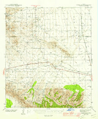
Editions of this 1944 Fisher Hills Map
3 editions found
Other maps of this area

1917 · San Simon
USGS Topo · 1:125,000

1922 · Willcox
USGS Topo · 1:125,000

1926 · Cochise Head
USGS Topo · 1:62,500

1928 · Bowie
USGS Topo · 1:62,500

1942 · Mt. Graham
USGS Topo · 1:62,500

1943 · Dos Cabezas
USGS Topo · 1:62,500

1943 · Willcox
USGS Topo · 1:62,500

1943 · Cochise
USGS Topo · 1:62,500

1944 · Fisher Hills
USGS Topo · 1:62,500

1945 · Mt. Graham
USGS Topo · 1:62,500