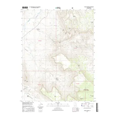
2017 Map of Fisher Towers
USGS Topo · Published 2017About this map
Fisher Towers and the surrounding red rock landscape dominate this survey of Grand County. The settlement of Castle Valley lies in the southwest, positioned along Castle Cr near distinctive formations like Castle Rock and Priest and Nuns. The northern edge of the map is defined by the Colorado River and the treacherous Onion Creek Rapids, while the eastern portion climbs into the high elevations of the Manti-Lasal National Forest. This terrain is characterized by deep erosional features such as Mary Jane Canyon and Hellroaring Canyon, which drain the massive Adobe Mesa and Fisher Mesa. The map detail highlights the verticality of the region, specifically identifying iconic monoliths like The Titan, Titan Tower, and the Totem Pole, illustrating the geological complexity that has shaped local navigation and land use.
Find a feature on this map
44 named features on this map. Tap any name to fly to it.
Don’t see what you’re looking for? This feature index may not catch every label — zoom into the map to look around manually.
Map Details
Editions of this 2017 Fisher Towers Map
This is the sole edition of this map. No revisions or reprints were ever made.
Other maps of this area

1885 · La Sal
USGS Topo · 1:250,000

1954 · Mt. Waas 4 SW
USGS Topo · 1:24,000

1954 · Mt. Waas 4 NW
USGS Topo · 1:24,000

1954 · Mt. Waas 3 NE
USGS Topo · 1:24,000

1954 · Mt. Waas 3 SE
USGS Topo · 1:24,000

1954 · Mt. Waas 1 SW
USGS Topo · 1:24,000

1954 · Mt. Waas 3 NW
USGS Topo · 1:24,000

1954 · Mt. Waas 3 SW
USGS Topo · 1:24,000

1954 · Coates Creek
USGS Topo · 1:62,500

1954 · Polar Mesa
USGS Topo · 1:62,500