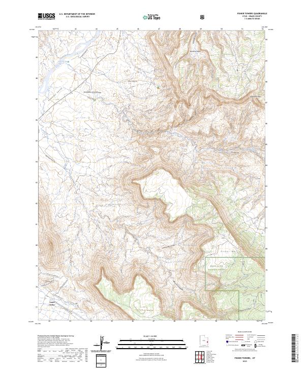
2023 Map of Fisher Towers
USGS Topo · Published 2023About this map
Professor Valley and the surrounding red rock drainages define this modern topographic study of Grand County. The Colorado River flows through the northern reaches, marked by the Onion Creek Rapid where the river meets the mouth of Onion Creek. The landscape is dominated by massive elevated formations, including the expansive Richardson Amphitheater, Fisher Mesa, and Adobe Mesa. To the south, the settlement of Castle Valley sits near the junction of Castle Creek and Mountain Loop Rd. The eastern portion of the map covers protected lands within the Manti-La Sal National Forest, where deep incisions like Mary Jane Canyon and Hellroaring Canyon carve through the plateau. A network of primitive roads, such as Fisher Tower Rd and Onion Creek Rd, provides the primary access into these remote basins and canyon systems.
Find a feature on this map
28 named features on this map. Tap any name to fly to it.
Don’t see what you’re looking for? This feature index may not catch every label — zoom into the map to look around manually.
Map Details
Editions of this 2023 Fisher Towers Map
This is the sole edition of this map. No revisions or reprints were ever made.
Other maps of this area

1885 · La Sal
USGS Topo · 1:250,000

1954 · Mt. Waas 4 SW
USGS Topo · 1:24,000

1954 · Mt. Waas 4 NW
USGS Topo · 1:24,000

1954 · Mt. Waas 3 NE
USGS Topo · 1:24,000

1954 · Mt. Waas 3 SE
USGS Topo · 1:24,000

1954 · Mt. Waas 1 SW
USGS Topo · 1:24,000

1954 · Mt. Waas 3 NW
USGS Topo · 1:24,000

1954 · Mt. Waas 3 SW
USGS Topo · 1:24,000

1954 · Coates Creek
USGS Topo · 1:62,500

1954 · Polar Mesa
USGS Topo · 1:62,500