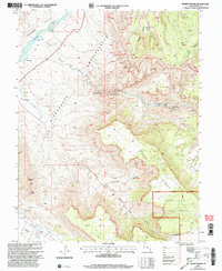
2001 Map of Fisher Towers
USGS Topo · Published 2004About this map
Colorado River currents flow past the Onion Creek Rapids as they cut through the geological complexity of Grand County at the turn of the 21st century. This survey reveals a landscape of massive red rock formations and deep canyons, dominated by the vertical spires of Fisher Towers, Titan Tower, and the Totem Pole. Human activity is sparse but notable, with the Richardson (Site) marking a former settlement location near the river, while Titus Ranch persists further north. The southern portion of the map transitions into the Manti-La Sal National Forest, where the terrain rises toward Adobe Mesa. This document tracks the persistence of old mining interest through scattered Mines and Gravel Pits while recording the prominent landmarks like Castle Rock and the Priest and Nuns that serve as vital navigation points in the high desert.
Find a feature on this map
61 named features on this map. Tap any name to fly to it.
Don’t see what you’re looking for? This feature index may not catch every label — zoom into the map to look around manually.
Map Details
Editions of this 2001 Fisher Towers Map
This is the sole edition of this map. No revisions or reprints were ever made.
Other maps of this area

1885 · La Sal
USGS Topo · 1:250,000

1954 · Mt. Waas 4 SW
USGS Topo · 1:24,000

1954 · Mt. Waas 4 NW
USGS Topo · 1:24,000

1954 · Mt. Waas 3 NE
USGS Topo · 1:24,000

1954 · Mt. Waas 3 SE
USGS Topo · 1:24,000

1954 · Mt. Waas 1 SW
USGS Topo · 1:24,000

1954 · Mt. Waas 3 NW
USGS Topo · 1:24,000

1954 · Mt. Waas 3 SW
USGS Topo · 1:24,000

1954 · Coates Creek
USGS Topo · 1:62,500

1954 · Polar Mesa
USGS Topo · 1:62,500