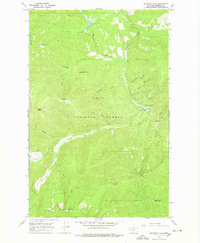
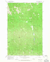
1966 Map of Fishtrap Lake
USGS Topo · Published 1978About this map
Lolo National Forest and Kaniksu National Forest converge in this mid-1960s survey of the Sanders County backcountry. The landscape is defined by the drainage of Fishtrap Creek and its many tributaries, including Little Fishtrap Creek and Whiteface Creek. Human activity is concentrated around the Fishtrap Work Center and the Fishtrap Campground near the confluence of these waters, while higher elevations are marked by peaks like Benson Peak and Lone Tree Peak. The map reveals a network of primitive transportation routes, specifically the West Fork Fishtrap Trail (Pack) and the Mt Headley Marmot Peak Trail (Pack), which provided access for forestry and fire management before more modern road networks were fully established. Small-scale resource extraction is noted by a Quarry near the creek, illustrating the local materials used for maintaining these remote forest corridors.
Find a feature on this map
28 named features on this map. Tap any name to fly to it.
Don’t see what you’re looking for? This feature index may not catch every label — zoom into the map to look around manually.
Map Details
Editions of this 1966 Fishtrap Lake Map
2 editions found
Other maps of this area

1937 · Thompson Falls
USGS Topo · 1:125,000

1937 · Thompson Falls
USGS Topo · 1:62,500

1956 · Wallace
USGS Topo · 1:250,000

1957 · Thompson Falls
USGS Topo · 1:62,500

1960 · Wallace
USGS Topo · 1:250,000

1964 · Calico Creek
USGS Topo · 1:24,000
1964 · Priscilla Peak
USGS Topo · 1:24,000

1966 · Vermilion Peak
USGS Topo · 1:24,000
1966 · Bend
USGS Topo · 1:24,000
1966 · Miller Lake
USGS Topo · 1:24,000