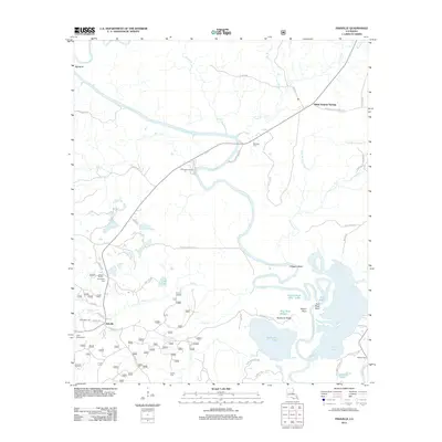
2012 Map of Fishville
USGS Topo · Published 2012About this map
Little River winds through a complex landscape of backwater lakes and winding bayous in this 2012 survey of central Louisiana. The settlement of Fishville serves as a focal point near the southwestern corner, situated near Camp Mary Lee and Camp Windywood. To the northeast, the historic area of White Sulphur Springs is marked along the road network, while the river itself creates dramatic features like Alligator Bend and Pelican Point.
Find a feature on this map
60 named features on this map. Tap any name to fly to it.
Don’t see what you’re looking for? This feature index may not catch every label — zoom into the map to look around manually.
Map Details
Editions of this 2012 Fishville Map
This is the sole edition of this map. No revisions or reprints were ever made.
Other maps of this area

1936 · Pollock
USGS Topo · 1:62,500

1941 · Jena
USGS Topo · 1:62,500

1941 · Alexandria
USGS Topo · 1:62,500

1941 · Buckeye
USGS Topo · 1:62,500

1941 · Pollock
USGS Topo · 1:62,500

1953 · Alexandria
USGS Topo · 1:250,000

1955 · Alexandria
USGS Topo · 1:250,000

1957 · Alexandria
USGS Topo · 1:62,500

1958 · Pollock
USGS Topo · 1:62,500

1958 · Jena
USGS Topo · 1:62,500