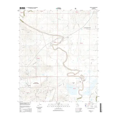
2015 Map of Fishville
USGS Topo · Published 2015About this map
White Sulphur Springs and the surrounding pine woods of the Kisatchie National Forest define this central Louisiana landscape. Situated along the border of La Salle and Grant Parish, the area is characterized by the winding path of the Little River, which forms dramatic oxbows and points such as Alligator Bend and Pelican Point. The settlement of Fishville sits near the junction of Big Creek and Exchange Club Road, serving as a gateway to the numerous lakes and ridges that dot the southern portion of the quadrangle.
Find a feature on this map
63 named features on this map. Tap any name to fly to it.
Don’t see what you’re looking for? This feature index may not catch every label — zoom into the map to look around manually.
Map Details
Editions of this 2015 Fishville Map
This is the sole edition of this map. No revisions or reprints were ever made.
Other maps of this area

1936 · Pollock
USGS Topo · 1:62,500

1941 · Jena
USGS Topo · 1:62,500

1941 · Alexandria
USGS Topo · 1:62,500

1941 · Buckeye
USGS Topo · 1:62,500

1941 · Pollock
USGS Topo · 1:62,500

1953 · Alexandria
USGS Topo · 1:250,000

1955 · Alexandria
USGS Topo · 1:250,000

1957 · Alexandria
USGS Topo · 1:62,500

1958 · Pollock
USGS Topo · 1:62,500

1958 · Jena
USGS Topo · 1:62,500