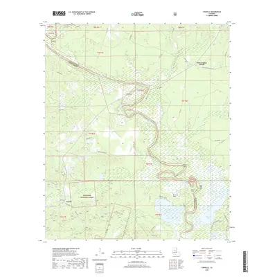
2018 Map of Fishville
USGS Topo · Published 2018About this map
Little River and its complex network of sloughs and brakes dominate this portion of Kisatchie National Forest near the border of Grant and LaSalle Parishes. The landscape is defined by the winding course of the river, which creates distinct geographical features such as Big Bend, Alligator Bend, and Fool River Bend. This area has long been shaped by its water and timber, with settlements like White Sulphur Springs and Fishville serving as local anchors. Local history is preserved in small burial grounds including Whatley Cem, Friendship Cem, and Leckie Cem. In the southern reaches, the terrain transitions into a dense wetland environment characterized by Hardwater Lake, Kitterlin Bay, and the prominent Backbone Ridge, illustrating the intricate drainage patterns of Clear Creek and Hurricane Cr.
Find a feature on this map
64 named features on this map. Tap any name to fly to it.
Don’t see what you’re looking for? This feature index may not catch every label — zoom into the map to look around manually.
Map Details
Editions of this 2018 Fishville Map
This is the sole edition of this map. No revisions or reprints were ever made.
Other maps of this area

1936 · Pollock
USGS Topo · 1:62,500

1941 · Jena
USGS Topo · 1:62,500

1941 · Alexandria
USGS Topo · 1:62,500

1941 · Buckeye
USGS Topo · 1:62,500

1941 · Pollock
USGS Topo · 1:62,500

1953 · Alexandria
USGS Topo · 1:250,000

1955 · Alexandria
USGS Topo · 1:250,000

1957 · Alexandria
USGS Topo · 1:62,500

1958 · Pollock
USGS Topo · 1:62,500

1958 · Jena
USGS Topo · 1:62,500