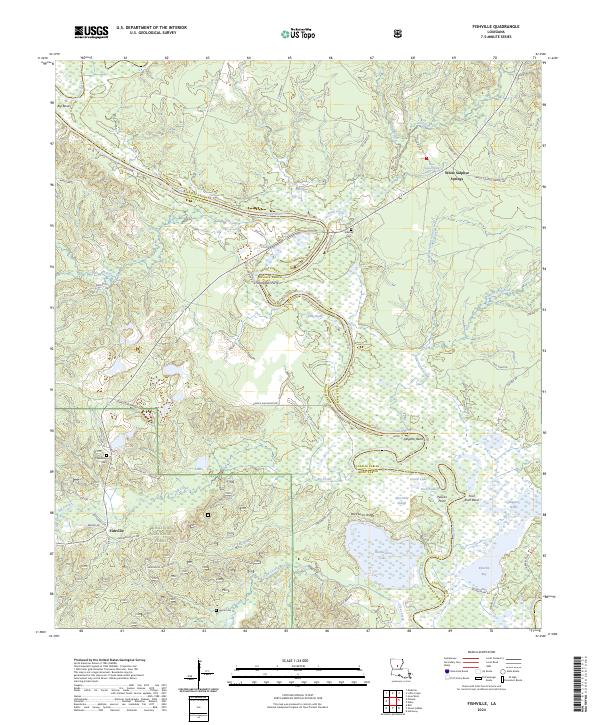
2024 Map of Fishville
USGS Topo · Published 2024About this map
Little River meanders across the landscape, defining the boundary between Grant and LaSalle Parishes. This area is characterized by dense wetlands and seasonal water bodies such as Alligator Brake, Goose Lake, and the expansive Kitterlin Bay. The terrain is marked by notable elevations like Backbone Ridge, which overlooks the Blue Hole Slough and Pelican Point. Much of the southern portion of the map is protected within the Kisatchie National Forest, preserving the wooded character surrounding the settlement of Fishville.
Find a feature on this map
67 named features on this map. Tap any name to fly to it.
Don’t see what you’re looking for? This feature index may not catch every label — zoom into the map to look around manually.
Map Details
Editions of this 2024 Fishville Map
This is the sole edition of this map. No revisions or reprints were ever made.
Other maps of this area

1936 · Pollock
USGS Topo · 1:62,500

1941 · Jena
USGS Topo · 1:62,500

1941 · Alexandria
USGS Topo · 1:62,500

1941 · Buckeye
USGS Topo · 1:62,500

1941 · Pollock
USGS Topo · 1:62,500

1953 · Alexandria
USGS Topo · 1:250,000

1955 · Alexandria
USGS Topo · 1:250,000

1957 · Alexandria
USGS Topo · 1:62,500

1958 · Pollock
USGS Topo · 1:62,500

1958 · Jena
USGS Topo · 1:62,500