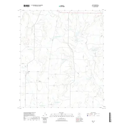
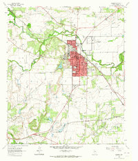
2019 Map of Fisk
USGS Topo · Published 2019About this map
The unincorporated community of Fisk serves as the focal point of this Central Texas landscape, situated at the intersection of FM 1026 and several county roads. The area is defined by its agrarian character and a complex network of water management features, including several large reservoirs such as Soil Conservation Service Site 12 Reservoir and Soil Conservation Service Site 18 Reservoir. These sites, along with the meandering paths of Home Cr and Red Bank Cr, illustrate the region's reliance on water conservation for ranching and agriculture. Genealogy researchers will find the Brown Ranch Cem located east of the main settlement, a quiet marker of the families who established the cattle and farming operations in this part of Coleman County. The map details a landscape of gentle relief, where small drainages like Loss Cr and Santa Anna Br carve subtle paths through the Texas brushland.
Find a feature on this map
39 named features on this map. Tap any name to fly to it.
Don’t see what you’re looking for? This feature index may not catch every label — zoom into the map to look around manually.
Map Details
Editions of this 2019 Fisk Map
This is the sole edition of this map. No revisions or reprints were ever made.
Other maps of this area

1887 · Coleman
USGS Topo · 1:125,000

1889 · Coleman
USGS Topo · 1:125,000

1892 · Ballinger
USGS Topo · 1:125,000

1932 · Voss
USGS Topo · 1:62,500

1954 · Brownwood
USGS Topo · 1:250,000
1962 · Speck Mountain
USGS Topo · 1:24,000
1962 · Gouldbusk
USGS Topo · 1:24,000

1962 · Santa Anna
USGS Topo · 1:24,000
1963 · Lake San Tana
USGS Topo · 1:24,000
1963 · Coleman
USGS Topo · 1:24,000