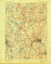
1893 Map of Fitchburg
USGS Topo · Published 1913About this map
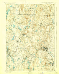
The Fitchburg Railroad serves as the industrial backbone of this late 19th-century landscape, branching into the Cheshire Branch and Peterboro and Shirley Br. to connect several manufacturing and mill towns. The city of Fitchburg sits at a critical junction where the Nashua River provides water power for local industry, surrounded by a ring of prominent heights like Rollstone Hill and Pearl Hill. To the south, Leominster and its surrounding reservoirs indicate the growing urban infrastructure required to support the region's expanding population.
Find a feature on this map
140 named features on this map. Tap any name to fly to it.
Don’t see what you’re looking for? This feature index may not catch every label — zoom into the map to look around manually.
Map Details
Editions of this 1893 Fitchburg Map
7 editions found

Other maps of this area

1885 · Worcester
USGS Topo · 1:62,500

1886 · Worcester
USGS Topo · 1:62,500

1887 · Winchendon
USGS Topo · 1:62,500

1887 · Marlboro
USGS Topo · 1:62,500

1887 · Barre
USGS Topo · 1:62,500

1887 · Fitchburg
USGS Topo · 1:62,500

1889 · Marlboro
USGS Topo · 1:62,500

1889 · Fitchburg
USGS Topo · 1:62,500

1889 · Barre
USGS Topo · 1:62,500

1890 · Winchendon
USGS Topo · 1:62,500