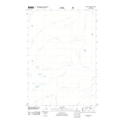
2011 Map of Fitsum Peak
USGS Topo · Published 2011About this map
Fitsum Peak and Nick Peak dominate this high-altitude landscape in Valley County, where a complex network of glacial and thermal features defines the terrain. The presence of Buckhorn Hot Spring along Buckhorn Creek suggests the geothermal activity common to this part of the Idaho wilderness, while the Rainbow Lakes and Buckhorn Lake sit in high basins formed by the region's sharp topography. Drainage is divided among several significant tributaries, including the various forks of Fitsum Creek and the West Fork Buckhorn Creek. The map documents a mostly roadless area, emphasizing natural landmarks like Sixmile Ridge and Krassell Knob rather than human settlements, making it an essential reference for understanding the primitive state of the backcountry in the early twenty-first century.
Find a feature on this map
19 named features on this map. Tap any name to fly to it.
Don’t see what you’re looking for? This feature index may not catch every label — zoom into the map to look around manually.
Map Details
Editions of this 2011 Fitsum Peak Map
This is the sole edition of this map. No revisions or reprints were ever made.
Other maps of this area

1956 · Elk City
USGS Topo · 1:250,000

1957 · Challis
USGS Topo · 1:250,000

1960 · Elk City
USGS Topo · 1:250,000

1960 · Challis
USGS Topo · 1:250,000

1963 · Challis
USGS Topo · 1:250,000

1969 · Enos Lake
USGS Topo · 1:24,000
1969 · Box Lake
USGS Topo · 1:24,000

1969 · Williams Peak
USGS Topo · 1:24,000

1973 · Blackmare
USGS Topo · 1:24,000

1973 · White Rock Peak
USGS Topo · 1:24,000