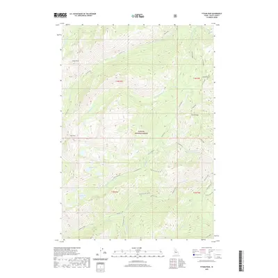
2020 Map of Fitsum Peak
USGS Topo · Published 2020About this map
Payette National Forest dominates this high-altitude terrain in Valley County, Idaho. The landscape is defined by a complex network of drainages and high summits, notably Fitsum Peak and Nick Peak in the west, and the long expanse of Sixmile Ridge to the east. This 2020 survey details a region shaped by its water sources, from the headwaters of Fitsum Creek and Buckhorn Creek to the secluded Rainbow Lakes.
Find a feature on this map
33 named features on this map. Tap any name to fly to it.
Don’t see what you’re looking for? This feature index may not catch every label — zoom into the map to look around manually.
Map Details
Editions of this 2020 Fitsum Peak Map
This is the sole edition of this map. No revisions or reprints were ever made.
Other maps of this area

1956 · Elk City
USGS Topo · 1:250,000

1957 · Challis
USGS Topo · 1:250,000

1960 · Elk City
USGS Topo · 1:250,000

1960 · Challis
USGS Topo · 1:250,000

1963 · Challis
USGS Topo · 1:250,000

1969 · Enos Lake
USGS Topo · 1:24,000
1969 · Box Lake
USGS Topo · 1:24,000

1969 · Williams Peak
USGS Topo · 1:24,000

1973 · Blackmare
USGS Topo · 1:24,000

1973 · White Rock Peak
USGS Topo · 1:24,000