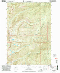
2004 Map of Fitsum Peak
USGS Topo · Published 2007About this map
Payette National Forest land defines this section of Valley County, showcasing a complex drainage system within the McCall Ranger District and Krassel Ranger District. The terrain is shaped by the divergent paths of Fitsum Creek and Buckhorn Creek, along with their respective north, south, and west forks. These waterways create a network of deep-cut drainages, including North Fork Fitsum Creek and West Fork Buckhorn Creek.
Find a feature on this map
13 named features on this map. Tap any name to fly to it.
Don’t see what you’re looking for? This feature index may not catch every label — zoom into the map to look around manually.
Map Details
Editions of this 2004 Fitsum Peak Map
This is the sole edition of this map. No revisions or reprints were ever made.
Other maps of this area

1956 · Elk City
USGS Topo · 1:250,000

1957 · Challis
USGS Topo · 1:250,000

1960 · Elk City
USGS Topo · 1:250,000

1960 · Challis
USGS Topo · 1:250,000

1963 · Challis
USGS Topo · 1:250,000

1969 · Enos Lake
USGS Topo · 1:24,000
1969 · Box Lake
USGS Topo · 1:24,000

1969 · Williams Peak
USGS Topo · 1:24,000

1973 · Blackmare
USGS Topo · 1:24,000

1973 · White Rock Peak
USGS Topo · 1:24,000