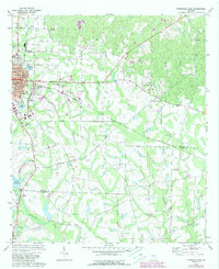
1972 Map of Fitzgerald East
USGS Topo · Published 1988About this map
Fitzgerald serves as the focal point of this South Georgia landscape, where the town's grid of streets like Alapaha St and Ohoopee St meets the agricultural expanse of Ben Hill Co. The map captures a transition from urban development, including the courthouse and Fitzgerald Country Club, to rural farming communities centered around small houses of worship such as New Mt Zion Ch and Pine Level Ch. A network of water bodies, including Lake Beatrice and the headwaters of Satilla Creek, defines the local drainage.
Find a feature on this map
41 named features on this map. Tap any name to fly to it.
Don’t see what you’re looking for? This feature index may not catch every label — zoom into the map to look around manually.
Map Details
Editions of this 1972 Fitzgerald East Map
2 editions found
Other maps of this area

1953 · Waycross
USGS Topo · 1:250,000

1958 · Waycross
USGS Topo · 1:250,000

1972 · Fitzgerald East
USGS Topo · 1:24,000

1972 · Ambrose
USGS Topo · 1:24,000

1972 · China Hill
USGS Topo · 1:24,000

1972 · Ocilla East
USGS Topo · 1:24,000

1972 · Queensland
USGS Topo · 1:24,000

1973 · Ocilla West
USGS Topo · 1:24,000

1973 · Fitzgerald West
USGS Topo · 1:24,000

1977 · Osierfield
USGS Topo · 1:24,000