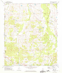
1971 Map of Fitzpatrick
USGS Topo · Published 1974About this map
The Old Indian Treaty Bdy cuts across the northeastern corner of this landscape, marking a significant historical frontier near the settlement of Fitzpatrick. This 1971 survey captures the rural character of the Bullock and Montgomery County line, where the Central of Georgia railroad serves as the primary industrial corridor, connecting smaller communities like Mitchell and Downing. The terrain is defined by a dense network of country churches and family-named landmarks, reflecting a deeply rooted community structure.
Find a feature on this map
28 named features on this map. Tap any name to fly to it.
Don’t see what you’re looking for? This feature index may not catch every label — zoom into the map to look around manually.
Map Details
Editions of this 1971 Fitzpatrick Map
2 editions found
Other maps of this area

1953 · Montgomery
USGS Topo · 1:250,000

1955 · Phenix City
USGS Topo · 1:250,000

1956 · Montgomery
USGS Topo · 1:250,000

1957 · Phenix City
USGS Topo · 1:250,000

1957 · Montgomery
USGS Topo · 1:250,000

1958 · Phenix City
USGS Topo · 1:250,000

1958 · Mount Meigs
USGS Topo · 1:62,500
1971 · China Grove
USGS Topo · 1:24,000

1971 · Hardaway
USGS Topo · 1:24,000

1971 · Thompson
USGS Topo · 1:24,000