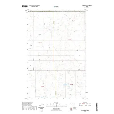
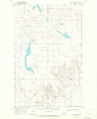
2020 Map of Fitzpatrick Lake
USGS Topo · Published 2020About this map
Canada lies along the northern edge of this Montana high plains landscape, where the international boundary meets the intersection of Glacier and Toole counties. The terrain is defined by a series of deep drainage features known as coulees, which carve through the prairie towards the Red River. These natural depressions, including Pearsons and Fitzpatrick, served as critical landmarks and water-collection points in a region otherwise characterized by alkaline basins. A network of rural section-line roads, such as Red River Rd and E Sweetgrass Rd, provides access to the isolated ranchlands and water bodies like Alkali Lake and Fitzpatrick Lake. The map illustrates the persistent 19th-century Public Land Survey System grid, which continues to organize the settlement patterns and land use of these northern borderlands.
Find a feature on this map
23 named features on this map. Tap any name to fly to it.
Don’t see what you’re looking for? This feature index may not catch every label — zoom into the map to look around manually.
Map Details
Editions of this 2020 Fitzpatrick Lake Map
This is the sole edition of this map. No revisions or reprints were ever made.
Other maps of this area

1909 · Cut Bank
USGS Topo · 1:125,000

1912 · Cut Bank
USGS Topo · 1:125,000

1960 · Cut Bank
USGS Topo · 1:250,000

1963 · Cut Bank
USGS Topo · 1:250,000

1964 · Cut Bank
USGS Topo · 1:250,000

1968 · Headlight Butte NE
USGS Topo · 1:24,000
1968 · Hillside Colony
USGS Topo · 1:24,000
1968 · Mountain View School
USGS Topo · 1:24,000
1968 · Fitzpatrick Lake
USGS Topo · 1:24,000
1968 · Glacier Colony
USGS Topo · 1:24,000