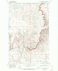
1968 Map of Mountain View School
USGS Topo · Published 1972About this map
Mountain View School and the surrounding high plains of Toole County define this late 1960s survey of the Montana landscape. The map captures a transition between the elevated plateaus and the deep, eroded paths of Healy Coulee and Rocky Springs Coulee. These drainage patterns are interspersed with evidence of the region's energy and water infrastructure, including the Kevin Sunburst Pipeline, a prominent Aqueduct, and scattered Oil Wells.
Find a feature on this map
13 named features on this map. Tap any name to fly to it.
Don’t see what you’re looking for? This feature index may not catch every label — zoom into the map to look around manually.
Map Details
Editions of this 1968 Mountain View School Map
This is the sole edition of this map. No revisions or reprints were ever made.
Other maps of this area

1909 · Cut Bank
USGS Topo · 1:125,000

1912 · Cut Bank
USGS Topo · 1:125,000

1939 · Sunburst
USGS Topo · 1:62,500

1943 · Shelby
USGS Topo · 1:62,500

1954 · Shelby
USGS Topo · 1:250,000

1958 · Shelby
USGS Topo · 1:250,000

1960 · Cut Bank
USGS Topo · 1:250,000

1963 · Cut Bank
USGS Topo · 1:250,000

1964 · Cut Bank
USGS Topo · 1:250,000

1966 · Ethridge NW
USGS Topo · 1:24,000