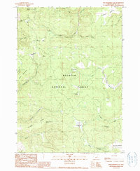
1990 Map of Five Hundred Flat
USGS Topo · Published 1990About this map
Malheur National Forest encompasses the high country of Grant County in this 1990 survey, showing a landscape defined by seasonal grazing and vital water sources. The map identifies specific historical locations like the Elkhorn Cow Camp (Site) and the Cheatem Holler Camp (Site), markers of the region's ranching heritage. Diverse topography includes the geologically distinct The Potholes and prominent heights such as Smoky Mtn. Natural meadows like Smith Meadows, Wymer Meadow, and Myrtle Park Meadows provide level openings within the timbered slopes. An intricate network of springs, including Lost Cabin Spring, Five Hundred Flat Spring, and Gilbert Ridge Spring, feeds the headwaters of Scotty Creek and Crooked Creek. This provisional edition captures the drainage patterns and primitive camps of the eastern Oregon wilderness before more modern road developments took place.
Find a feature on this map
33 named features on this map. Tap any name to fly to it.
Don’t see what you’re looking for? This feature index may not catch every label — zoom into the map to look around manually.
Map Details
Editions of this 1990 Five Hundred Flat Map
This is the sole edition of this map. No revisions or reprints were ever made.
Other maps of this area

1955 · Burns
USGS Topo · 1:250,000

1955 · Canyon City
USGS Topo · 1:250,000

1958 · Burns
USGS Topo · 1:250,000

1959 · Burns
USGS Topo · 1:250,000

1959 · Canyon City
USGS Topo · 1:250,000

1959 · West Myrtle Butte
USGS Topo · 1:62,500

1959 · Sawtooth Creek
USGS Topo · 1:62,500

1961 · Logdell
USGS Topo · 1:62,500

1961 · Izee
USGS Topo · 1:62,500

1981 · Dayville
USGS Topo · 1:100,000