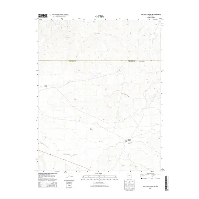
2013 Map of Five Lakes Canyon NW
USGS Topo · Published 2013About this map
Twin Tanks Windmill stands as a central landmark in this high-desert landscape where the boundary between Rio Arriba County and Sandoval County is defined by the high plateaus and deep drainage networks of northern New Mexico. The geography is dominated by a complex system of dry washes and canyons, most notably Five Lakes Canyon and the broad reach of Cañon Largo. These natural corridors, along with Menfee Canyon and Bonita Canyon, illustrate the erosional patterns that have shaped the region's accessibility for generations. A notable detail for those studying historical travel and land use is the explicit marking of No Access Roads Sandy, highlighting the literal physical barriers presented by the local terrain and the isolation of these drainage basins near Burro Canyon and Chacon Canyon.
Find a feature on this map
17 named features on this map. Tap any name to fly to it.
Don’t see what you’re looking for? This feature index may not catch every label — zoom into the map to look around manually.
Map Details
Editions of this 2013 Five Lakes Canyon NW Map
This is the sole edition of this map. No revisions or reprints were ever made.
Other maps of this area

1889 · Largo
USGS Topo · 1:250,000

1895 · Largo
USGS Topo · 1:250,000

1954 · Aztec
USGS Topo · 1:250,000

1958 · Aztec
USGS Topo · 1:250,000

1962 · Aztec
USGS Topo · 1:250,000

1963 · Otero Store
USGS Topo · 1:24,000

1963 · Lindrith
USGS Topo · 1:24,000
1963 · Arroyo Chijuillita
USGS Topo · 1:24,000
1963 · Billy Rice Canyon
USGS Topo · 1:24,000
1963 · Taylor Ranch
USGS Topo · 1:24,000