
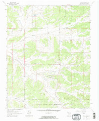
1963 Map of Lindrith
USGS Topo · Published 1965About this map
Lindrith stands at the center of this high-altitude landscape, situated within the productive San Juan Basin gas field during the early 1960s. The map illustrates a transitional zone where ranching and energy extraction meet the northern edge of the Jicarilla Apache Indian Reservation. The terrain is deeply incised by a series of drainages, including Cañada Larga, Gavilan Canyon, and Oso Canyon, which dictate the placement of local infrastructure.
Find a feature on this map
22 named features on this map. Tap any name to fly to it.
Don’t see what you’re looking for? This feature index may not catch every label — zoom into the map to look around manually.
Map Details
Editions of this 1963 Lindrith Map
2 editions found
Other maps of this area

1889 · Largo
USGS Topo · 1:250,000

1895 · Largo
USGS Topo · 1:250,000

1909 · Gallina
USGS Topo · 1:125,000

1940 · Cuba
USGS Topo · 1:62,500

1943 · Cuba
USGS Topo · 1:62,500

1954 · Aztec
USGS Topo · 1:250,000

1955 · Llaves
USGS Topo · 1:62,500

1958 · Aztec
USGS Topo · 1:250,000

1962 · Aztec
USGS Topo · 1:250,000

1963 · Schmitz Ranch
USGS Topo · 1:24,000