
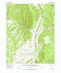
1955 Map of Llaves
USGS Topo · Published 1957About this map
The Continental Divide snakes through this high-altitude landscape of Rio Arriba County, defining a complex network of canyons and plateaus. Much of the eastern portion lies within the Santa Fe National Forest, where prominent summits like Gallina Peak and Dead Mans Peak rise above the drainage of the Rio Gallina. The settlement at Llaves serves as a small hub amidst a rugged terrain characterized by numerous ephemeral springs and lagoons, including Laguna Colorado and Mud Spring.
Find a feature on this map
54 named features on this map. Tap any name to fly to it.
Don’t see what you’re looking for? This feature index may not catch every label — zoom into the map to look around manually.
Map Details
Editions of this 1955 Llaves Map
2 editions found
Other maps of this area

1889 · Largo
USGS Topo · 1:250,000

1895 · Largo
USGS Topo · 1:250,000

1909 · Gallina
USGS Topo · 1:125,000

1940 · Cuba
USGS Topo · 1:62,500

1943 · Cuba
USGS Topo · 1:62,500

1953 · Arroyo Del Agua
USGS Topo · 1:24,000

1953 · Laguna Peak
USGS Topo · 1:24,000

1953 · Navajo Peak
USGS Topo · 1:24,000
1953 · Youngsville
USGS Topo · 1:62,500

1954 · Aztec
USGS Topo · 1:250,000