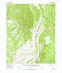
1955 Map of Llaves
USGS Topo · Published 1966About this map
Gallina Mountain and the high desert plateaus of Rio Arriba County dominate this mid-century topographic record, where the Continental Divide winds through a landscape of deep canyons and seasonal arroyos. The small settlement of Llaves serves as a central point in an area defined by scattered ranching operations like Syphers Ranch and Coline Ranch. The survey highlights a mix of cultural history and natural resources, from ancient Cliff Dwellings near Wolf Canyon to modern industrial markers like the Kern Mine and an Oil Well.
Find a feature on this map
61 named features on this map. Tap any name to fly to it.
Don’t see what you’re looking for? This feature index may not catch every label — zoom into the map to look around manually.
Map Details
Editions of this 1955 Llaves Map
2 editions found

Other maps of this area

1889 · Largo
USGS Topo · 1:250,000

1895 · Largo
USGS Topo · 1:250,000

1909 · Gallina
USGS Topo · 1:125,000

1940 · Cuba
USGS Topo · 1:62,500

1943 · Cuba
USGS Topo · 1:62,500

1953 · Arroyo Del Agua
USGS Topo · 1:24,000

1953 · Laguna Peak
USGS Topo · 1:24,000

1953 · Navajo Peak
USGS Topo · 1:24,000
1953 · Youngsville
USGS Topo · 1:62,500

1954 · Aztec
USGS Topo · 1:250,000