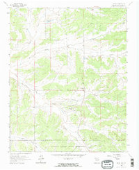
1963 Map of Lindrith
USGS Topo · Published 1985About this map
Lindrith serves as a remote hub in northern Rio Arriba County, appearing here during the early 1960s as a center for regional energy and ranching interests. The settlement is anchored by the Lindrith Cem and a nearby Landing Strip, while the landscape to the south is dominated by the boundaries of the Jicarilla Apache Indian Reservation. The terrain is defined by a series of deep drainage systems, including Cañada Larga and Gavilan Canyon, which intersect the high plateau country. Several Gas Wells and an extensive network of Pipelines illustrate the intensifying industrial development within the San Juan Basin during this era. Distinctive local landmarks like Gavilan Lake and the Ojito Camp provide specific points of interest for those tracing the mid-century geography of this high-desert region.
Find a feature on this map
14 named features on this map. Tap any name to fly to it.
Don’t see what you’re looking for? This feature index may not catch every label — zoom into the map to look around manually.
Map Details
Editions of this 1963 Lindrith Map
2 editions found

Other maps of this area

1889 · Largo
USGS Topo · 1:250,000

1895 · Largo
USGS Topo · 1:250,000

1909 · Gallina
USGS Topo · 1:125,000

1940 · Cuba
USGS Topo · 1:62,500

1943 · Cuba
USGS Topo · 1:62,500

1954 · Aztec
USGS Topo · 1:250,000

1955 · Llaves
USGS Topo · 1:62,500

1958 · Aztec
USGS Topo · 1:250,000

1962 · Aztec
USGS Topo · 1:250,000

1963 · Schmitz Ranch
USGS Topo · 1:24,000